Magnetometers
-
MagNIMBUS atomic total-field magnetometer
SPH EngineeringUltra-sensitive airborne integrated magnetometer system powered by QuSpin QTFM Gen-2 atomic total-field magnetometer sensors Typical applications a...
View full details -
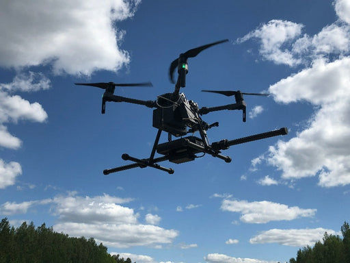

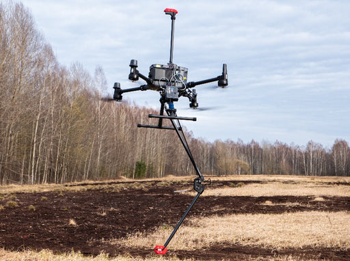
SENSYS MagDrone R3 magnetometer
SENSYSThe MagDrone R3 is an ultra portable magnetometer to be attached to any UAV with a minimum payload of 1kg. Recommended applications: Searching for...
View full details -
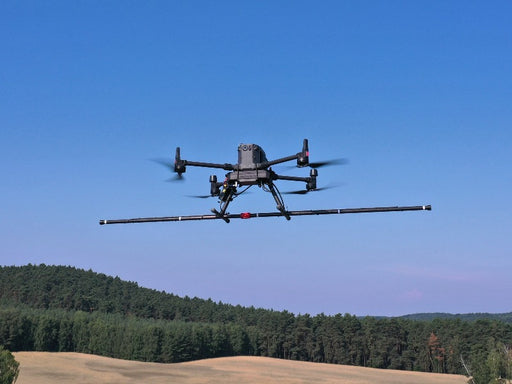
SENSYS MagDrone R4 magnetometer
SENSYSThe MagDrone R4 is an ultra light weight magnetometer with 5 triaxial Fluxgates to be attached to any UAV capable to carry 2 kg of payload. In oppo...
View full details -
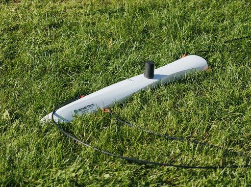
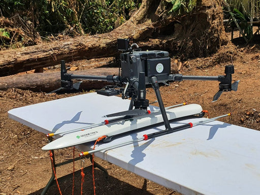
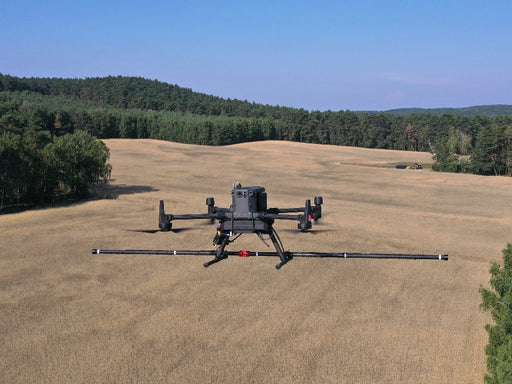
Geometrics MagArrow Mk2 magnetometer
GeometricsUltra-sensitive lightweight magnetometer for UAV. The MagArrow II is the second generation of Geometrics best-selling magnetometer. MagArrow is fu...
View full details -

 Original price 6,230.00 USD - Original price 6,230.00 USDOriginal price6,230.00 USD6,230.00 USD - 6,230.00 USDCurrent price 6,230.00 USD
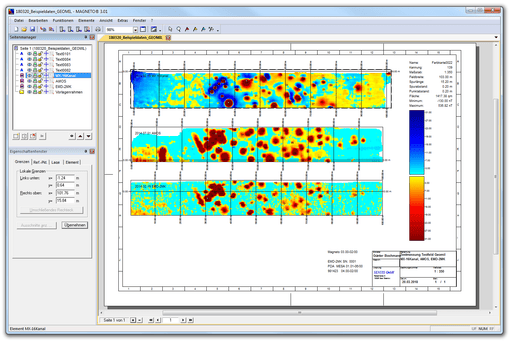
SENSYS MAGNETO® data processing software
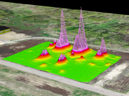
SENSYSSENSYS MAGNETO® is a software for the comprehensive analysis and interpretation of data gathered using MagDrone R3 and MagDrone R4 magnetometers.MA...
View full detailsOriginal price 6,230.00 USD - Original price 6,230.00 USDOriginal price6,230.00 USD6,230.00 USD - 6,230.00 USDCurrent price 6,230.00 USD -
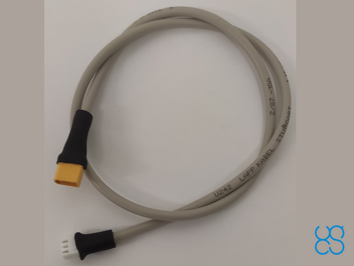 Original price 170.00 USD - Original price 170.00 USDOriginal price170.00 USD170.00 USD - 170.00 USDCurrent price 170.00 USD
SENSYS MagDrone R3 power cable
SPH EngineeringCable to provide power from SkyHub to SENSYS MagDrone R3 magnetometer eliminating the need for an additional battery.Especially convenient when use...
View full detailsOriginal price 170.00 USD - Original price 170.00 USDOriginal price170.00 USD170.00 USD - 170.00 USDCurrent price 170.00 USD -
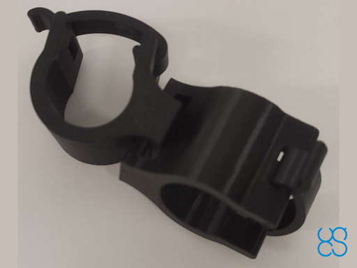 Original price 310.00 USD - Original price 310.00 USDOriginal price310.00 USD310.00 USD - 310.00 USDCurrent price 310.00 USD
SENSYS MagDrone R3 plastic mountings for DJI drones
SPH EngineeringCompatible with DJI M300/M350 RTK and M600 drones. MagDrone R3 mount consists of two interlocked parts – straight and angled. The straight part is ...
View full detailsOriginal price 310.00 USD - Original price 310.00 USDOriginal price310.00 USD310.00 USD - 310.00 USDCurrent price 310.00 USD -
 Original price 420.00 USD - Original price 420.00 USDOriginal price420.00 USD420.00 USD - 420.00 USDCurrent price 420.00 USD
Practical exam and certification: data collection, processing and interpretation
SPH EngineeringThe exam confirms practical knowledge and experience in data collection, processing and interpretation using systems supplied by SPH Engineering.Ho...
View full detailsOriginal price 420.00 USD - Original price 420.00 USDOriginal price420.00 USD420.00 USD - 420.00 USDCurrent price 420.00 USD


