Integrated Systems
-

 Original price 0.00 USD - Original price 0.00 USDOriginal price 0.00 USD42,010.00 USD42,010.00 USD - 42,010.00 USDCurrent price 42,010.00 USD
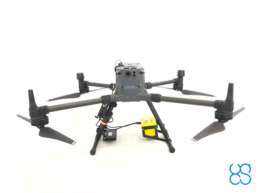
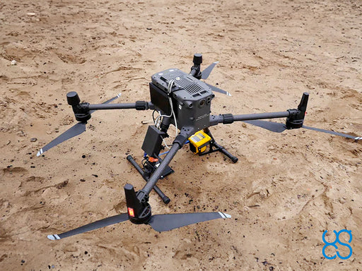
Laser Falcon methane detector bundle
SPH EngineeringLaser Falcon methane detector plus all required components and software for use with DJI M350/M300 drones (drone not included). For other types of ...
View full detailsOriginal price 0.00 USD - Original price 0.00 USDOriginal price 0.00 USD42,010.00 USD42,010.00 USD - 42,010.00 USDCurrent price 42,010.00 USD -
 Original price 23,600.00 USD - Original price 23,600.00 USDOriginal price23,600.00 USD23,600.00 USD - 23,600.00 USDCurrent price 23,600.00 USD
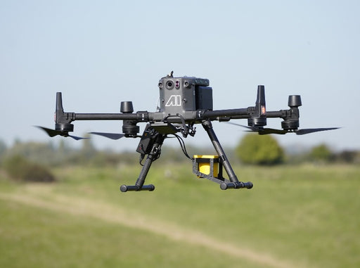
Laser Falcon methane detector
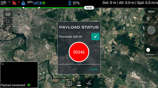
Tokyo Gas Engineering SolutionsLaser Falcon is sensitive only to methane, so no false readings of other gases are possible. It is a class 3R eye-safe laser. The concept is based ...
View full detailsOriginal price 23,600.00 USD - Original price 23,600.00 USDOriginal price23,600.00 USD23,600.00 USD - 23,600.00 USDCurrent price 23,600.00 USD -
 Original price 5,370.00 USD - Original price 5,370.00 USDOriginal price5,370.00 USD5,370.00 USD - 5,370.00 USDCurrent price 5,370.00 USD
FT Technologies FT742 wind speed and direction sensor kit
SPH EngineeringFT Technologies FT742 wind speed and direction sensor uses acoustic resonance technology.The hard anodized aluminum housing is highly resistant to ...
View full detailsOriginal price 5,370.00 USD - Original price 5,370.00 USDOriginal price5,370.00 USD5,370.00 USD - 5,370.00 USDCurrent price 5,370.00 USD -
 Original price 3,170.00 USD - Original price 3,170.00 USDOriginal price3,170.00 USD3,170.00 USD - 3,170.00 USDCurrent price 3,170.00 USD
SkyHub software package for Methane detector
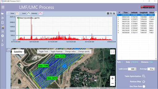
SPH EngineeringSoftware package for Methane detector integration. Includes firmware for SkyHub on-board computer and companion application for UgCS. Supports Lase...
View full detailsOriginal price 3,170.00 USD - Original price 3,170.00 USDOriginal price3,170.00 USD3,170.00 USD - 3,170.00 USDCurrent price 3,170.00 USD -
 Original price 2,920.00 USD - Original price 2,920.00 USDOriginal price2,920.00 USD2,920.00 USD - 2,920.00 USDCurrent price 2,920.00 USD
Training: Methane leak detection using drone
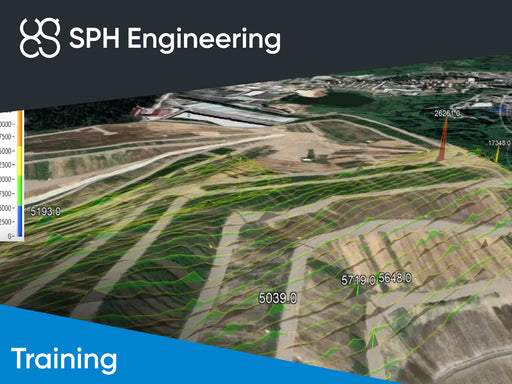
SPH EngineeringOnly one of its kind training to learn how to use Laser Falcon methane detector for drone surveys.Students should have the knowledge and practical ...
View full detailsOriginal price 2,920.00 USD - Original price 2,920.00 USDOriginal price2,920.00 USD2,920.00 USD - 2,920.00 USDCurrent price 2,920.00 USD -
 Original price 370.00 USD - Original price 370.00 USDOriginal price370.00 USD370.00 USD - 370.00 USDCurrent price 370.00 USD
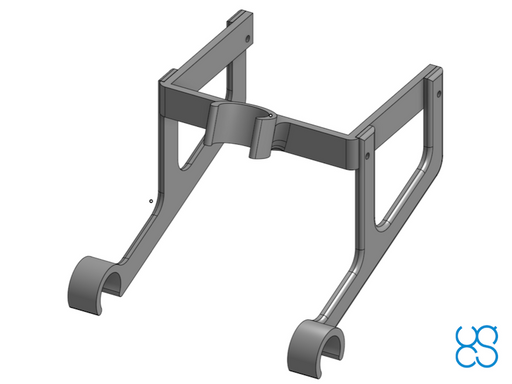
Laser Falcon methane detector mountings for DJI drones
SPH EngineeringMountings to fix the Laser Falcon methane detector on the leg of the DJI drone.
Original price 370.00 USD - Original price 370.00 USDOriginal price370.00 USD370.00 USD - 370.00 USDCurrent price 370.00 USD


