Hardware and software set designed to enhance commercial-off-the-shelf UAV capabilities for industrial purposes and to support the integration of diverse sensors
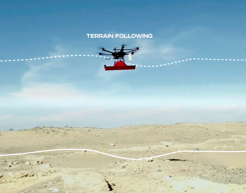
Implementation of True Terrain Following for DJI Drones
Implementation of Grasshopper mode, when a drone is flying between waypoints at a safe altitude and descends in waypoints to a set altitude to make measurements
Data collection from sensors (GPR, echo sounder, methane detector, gamma, etc.) which don’t have an internal data logger
Data fusion from Payload and Autopilot telemetry: SkyHub uses positioning information from the drone to geotag the sensor’s data
Provide a stream of NMEA coordinates to an external sensor
Support for external obstacle detectors to interrupt the flight and save the drone
Benefits
Safety and productivity • Truly remote sensing • Productivity in magnitudes of times higher compared with terrestrial methods
Hi-resolution data • Data gathered from extremely low altitudes with any required density • Data geotagged with cm-level precision
Industry - standard solutions • Only proven sensors from known manufacturers • Standard software for data processing (Oasis Montaj, Hydromagic, Prism2/GPR-Slice/Geolitix, etc.)
Sensors
Magnetometer
Scan the area and detect metals several times faster compared with handheld devices and obtain geo-referenced maps of the area.
Acquire subsurface data quickly, safely, and efficiently. Combine Ground Penetrating Radar (GPR) with drones to see through ground, ice, rocks, and water in tough spots.
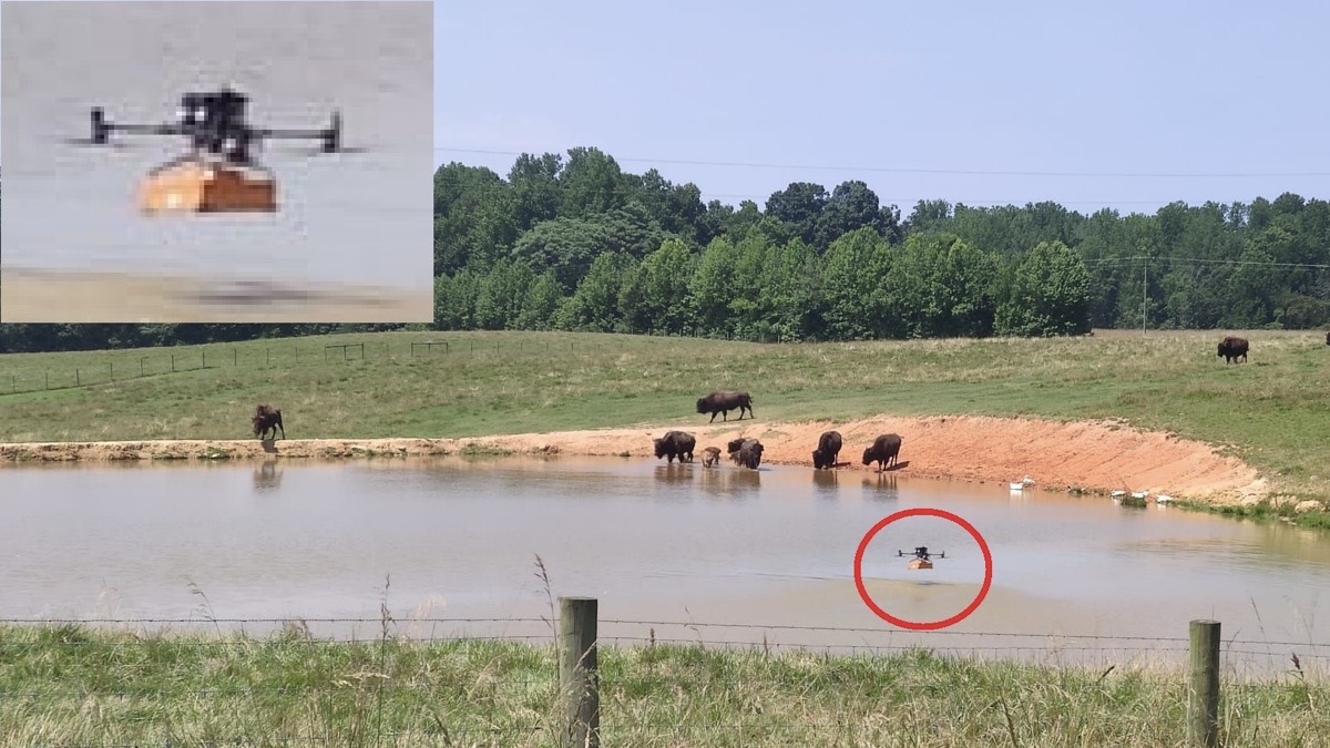
Bathymetric surveying for faster and more cost-efficient mapping of water depths and sediments. The best solution for hard-to-reach locations, and hazardous environments.
Deploy a combined remote methane detector and drone system for conducting surveys of natural gas pipelines, inspecting tanks, monitoring emissions in landfills, testing gas wells, and conducting safety audits within industrial plants.
Explore our geophysical sensor Test Range next to SPH Engineering's headquarters (Latvia, EU). The testing area spans 450x70 meters and is designed for UAV-based sensor evaluations.